Now with support of Google Maps, Here Technologies and Caliper Maptitude
Struggling with address geocoding, distance calculations, or demographic analysis in Excel? CDXZipStream is a Microsoft Windows Excel add-in that simplifies geographic data analysis. Quickly calculate driving distances, geocode addresses, and analyze demographics for targeted marketing campaigns directly within your spreadsheets. Process thousands of calculations effortlessly – simply define your data requirements and let CDXZipStream handle the complexities.
Features include:
- Easy, on-demand access from Excel, automatic data updating, and multiple demographic data feeds
- Compatible with multiple location data providers including Google Maps and others
- Supports the CDXGeodata web service to correct address lists with USPS Zip+4 data and approved formatting.
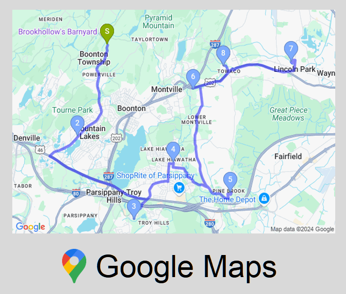
CDXZipStream offers up-to-date, worldwide coverage with roof-top accuracy. The software can be used to geocode, reverse-geocode, calculate driving distance and time, perform route optimization, verify addresses, look up USPS ZIP and Postal Codes and create maps.
Beyond U.S. and Canadian data, CDXZipStream includes functions to calculate ZIP code distance, distance between latitude/longitude points or addresses, ZIP Codes within a radius, reverse ZIP codes, and ZIP Code lists by city, county, or state. CDXZipStream also supports international databases for Mexico, India, and Western European countries, offering global geographic analysis capabilities.
CDXZipStream is compatible with Office 365 and all 32/64 bit versions of Excel 2010 and later versons. If you're a Mac user, explore our CDXGeodata spreadsheet apps or cloud-based Zip+4 Lookup and Demographics tools for similar functionality.
CDXZipStream pricing begins at $69.95, which includes a one-year subscription to our U.S. ZIP Code database. All versions come with a 30-day money back guarantee.